STEM

EFT-4: Oh, Shenandoah! High Altitude Balloon Launch #4

Date: 11 October 2015DSC_1690Equipment:  DS Rev 4 Launch: Fishers Hill, VA Landing: Luray, VA Time of Flight: 93 minutes Distance Travelled: 26 miles Burst Altitude: (~65,000 ft)

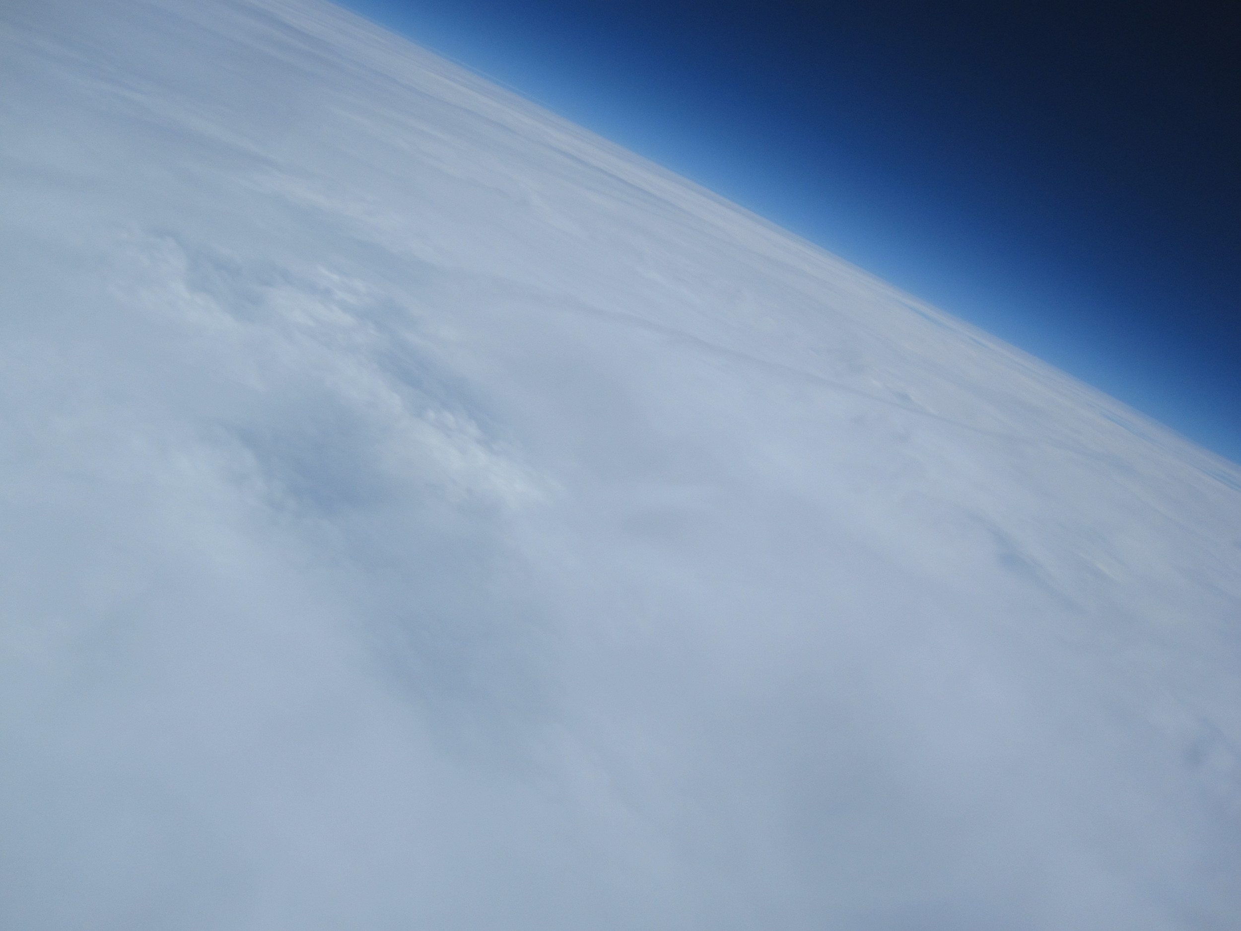
After the successful launch and recovery of our EFT-3 HAB, we were incredibly eager to put another Dogeship-class weather balloon back into the skies and capture some more stunning photos (and hopefully video) of the Earth. There is something truly awe-inspiring about sending a spacecraft high enough that only a tiny fraction of a percent of ALL of humanity that has ever existed has been able to accomplish a similar feat. We live in a wonderful time of endless technological possibilities and knowledge sharing that makes all of this possible.

One of our goals from the start has been to make this invigorating experience of capturing near-space photos of Earth’s curvature more accessible to those that may not think that it would be even possible: photographers, younger students, and those that have knowledge of perhaps some sub-system of the weather balloon craft but don’t have the skills or confidence that they would be able to pull off all the components that go into a HAB launch.

DSC_0962

Enter: EFT-4. Because of all the lessons that we learned throughout the first three launches, we have been assembling a step-by-step user guide that will walk through each of the critical aspects of a HAB Near-Space Weather Balloon launch, and hopefully lead to successful photos and recovery. EFT-4 was our first time letting two complete strangers that have never launched a weather balloon before to try out our user guide, our inflation system, and essentially launch a balloon with minimal guidance from us.

dsc_1002

We hope to share our knowledge and help anyone launch a weather balloon, and this user guide is now available for FREE download after signing up for our mailing list here.

Pre-Flight

As mentioned in the previous brief overview post of EFT-4, the plan was to flight-test our planned configuration that we had written the user guide around. The only additional component that we included on this flight for data-gathering purposes was our trusty Canon SD 780IS running the CHDK (Canon Hack Development Kit) software to take video on ascent while looking straight up at the balloon.

The details of the flight configuration for predictions of EFT-4 were:
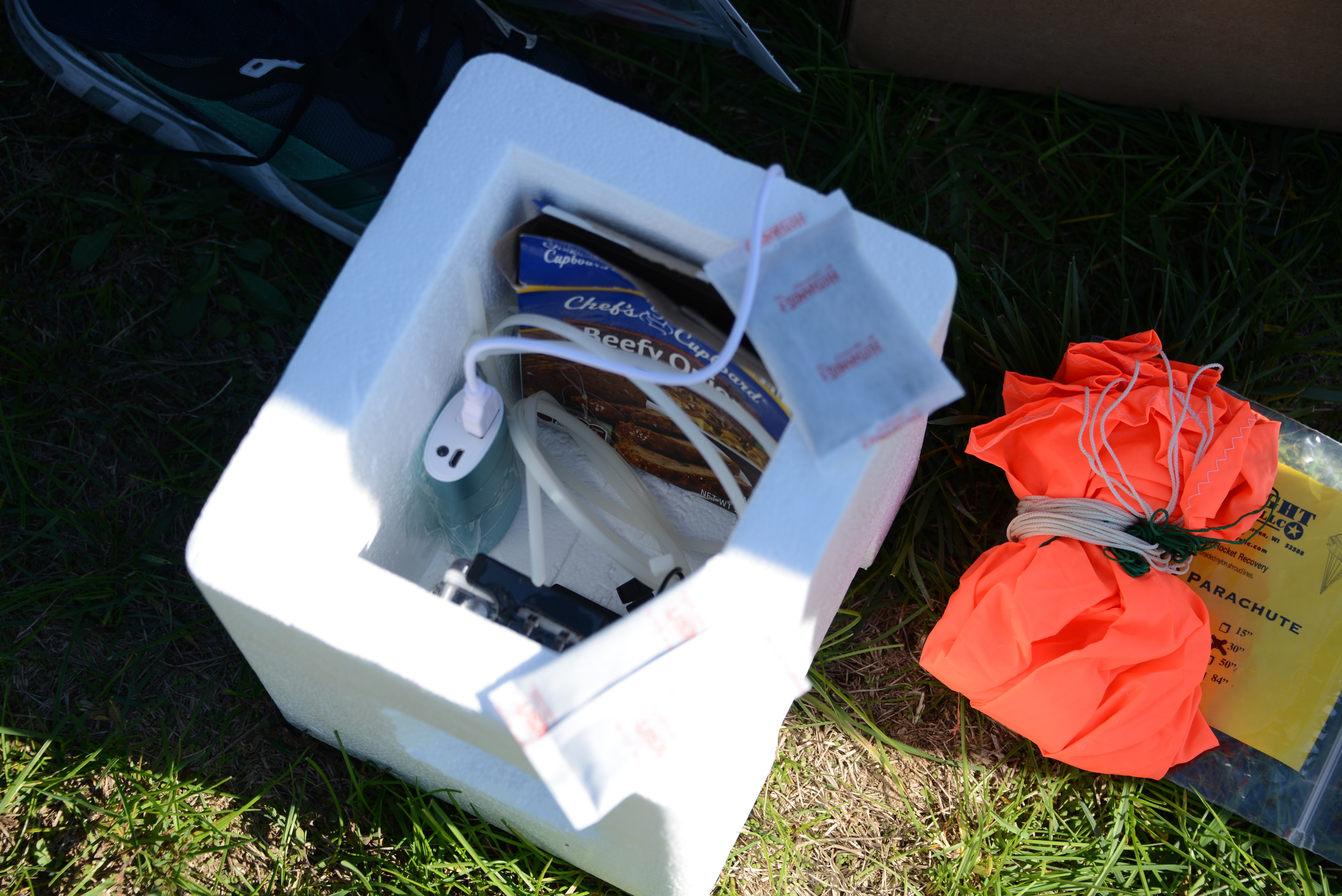
DSC_1006Payload Weight = 1.79lbs Nozzle Lift = 6.00 lbs (see an explanation of Nozzle Lift here) Parachute = 30” Cameras: 1 RioRand RS4000 (1080p video), 1 Canon SD780IS (720p video) Parachute to Balloon Length = 60” (one string) Parachute to Payload Attach = 40’ (one 40lb test string, attached to payload through two zipties)

Interestingly enough, the predicted winds on the launch date and time in the Shenandoah valley were southerly, and only expected to carry the balloon roughly 20-30 miles. If we planned it right, we may be able to catch a glimpse of our EFT-4 HAB on descent!

Launch Day
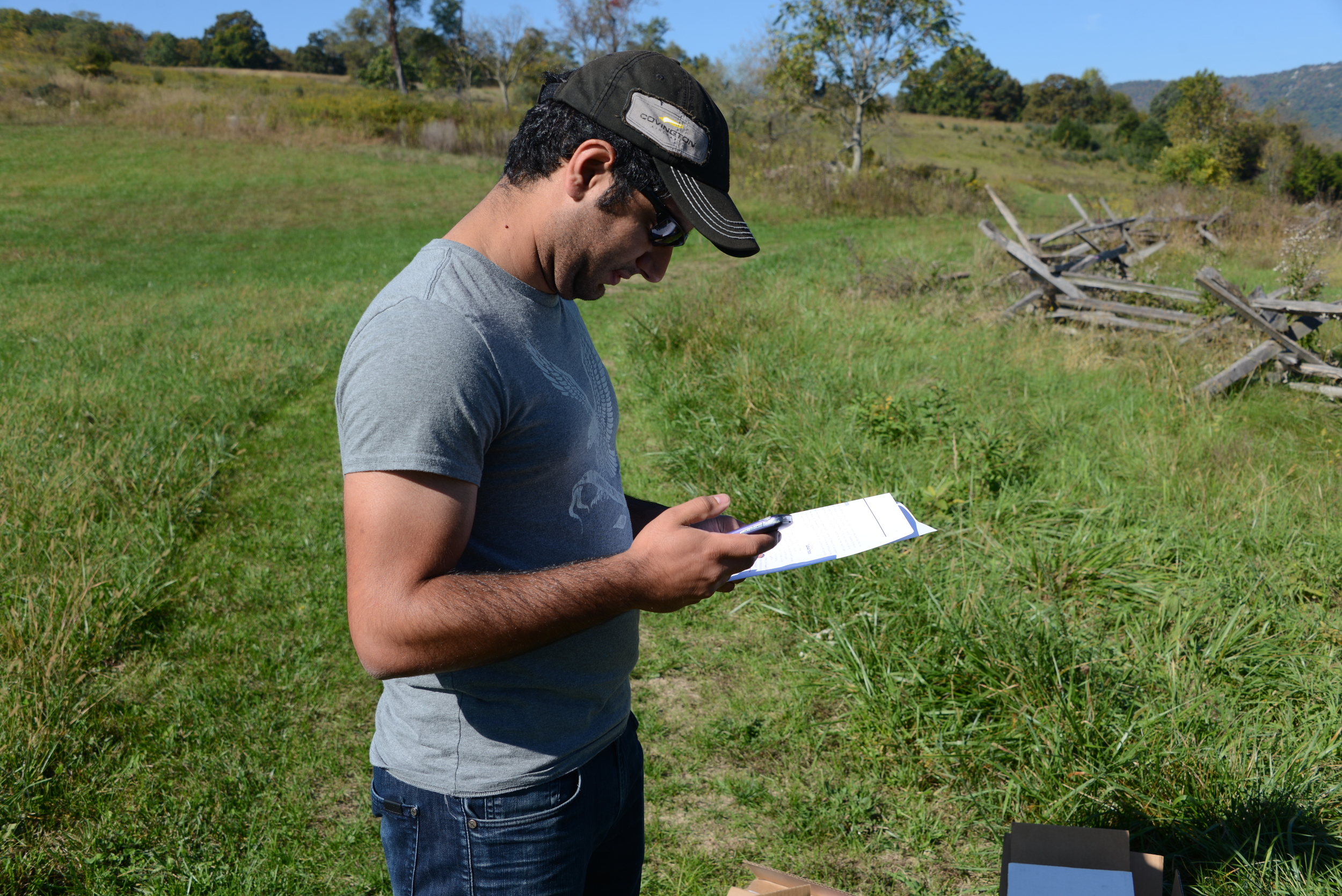
DSC_0966Our guinea pig for the day was Shahin. Although Shahin has an Aerospace background, the entire process of launching a weather balloon was entirely foreign to him. After running our last-minute pre-flight checks and selecting what seemed to be an appropriate launch site (an old Civil War Battlefield), we set out for our destination and prepared to launch.
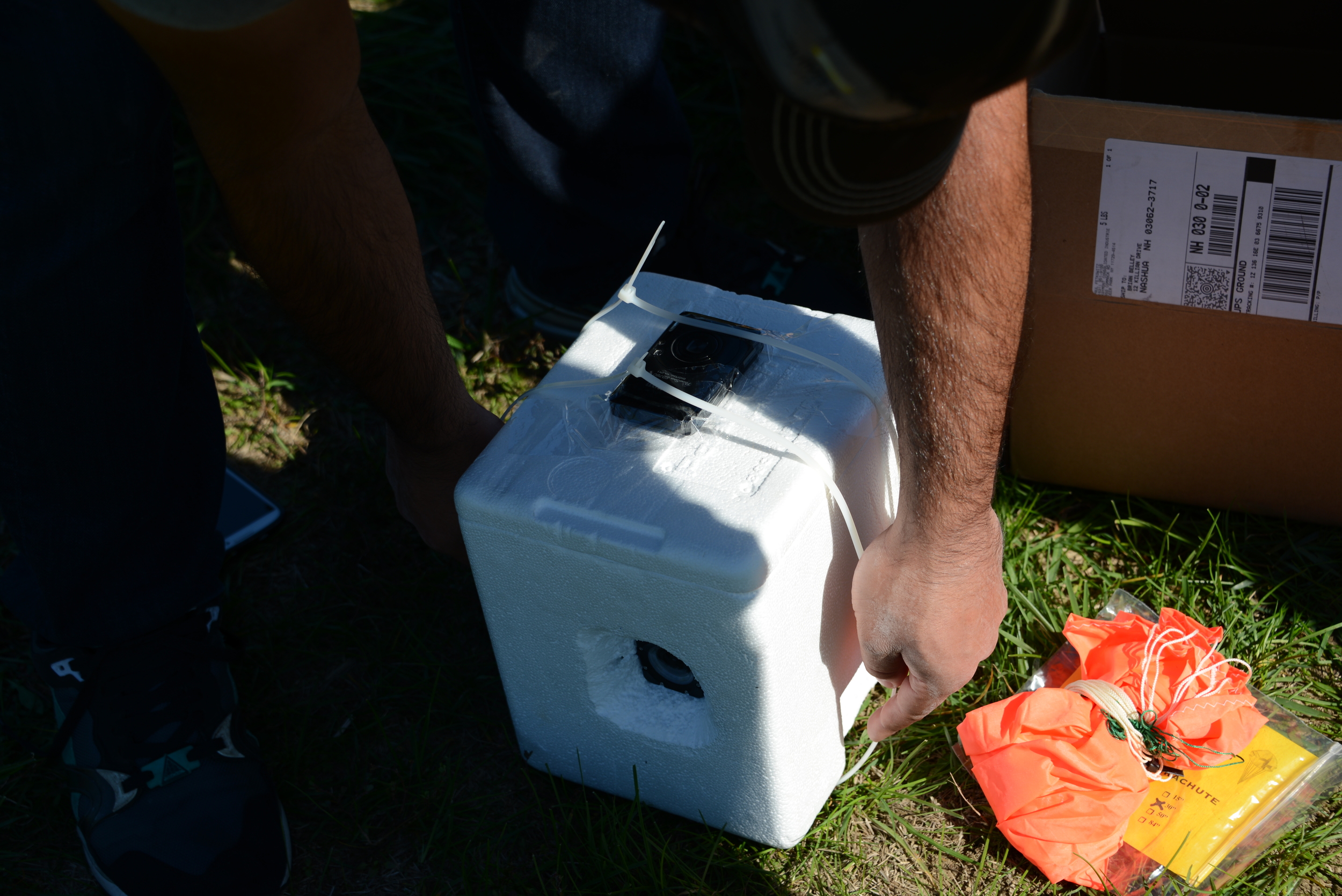
DSC_1163Although some questions arose during the process, which was our main intent of having someone unfamiliar run through the steps for launching the HAB, overall the pre-flight preparations ran smoothly. Another friend that had not taken part in a balloon launch before, Billy, had graciously offered to be the paparazzi for the day and captured photos during the entire process.

Fill_Time_Lapse_Small

With the payload prepped, balloon inflated, and all pre-flight checks indicating a GO, Shahin gave the customary launch speech, and away EFT-4 went!
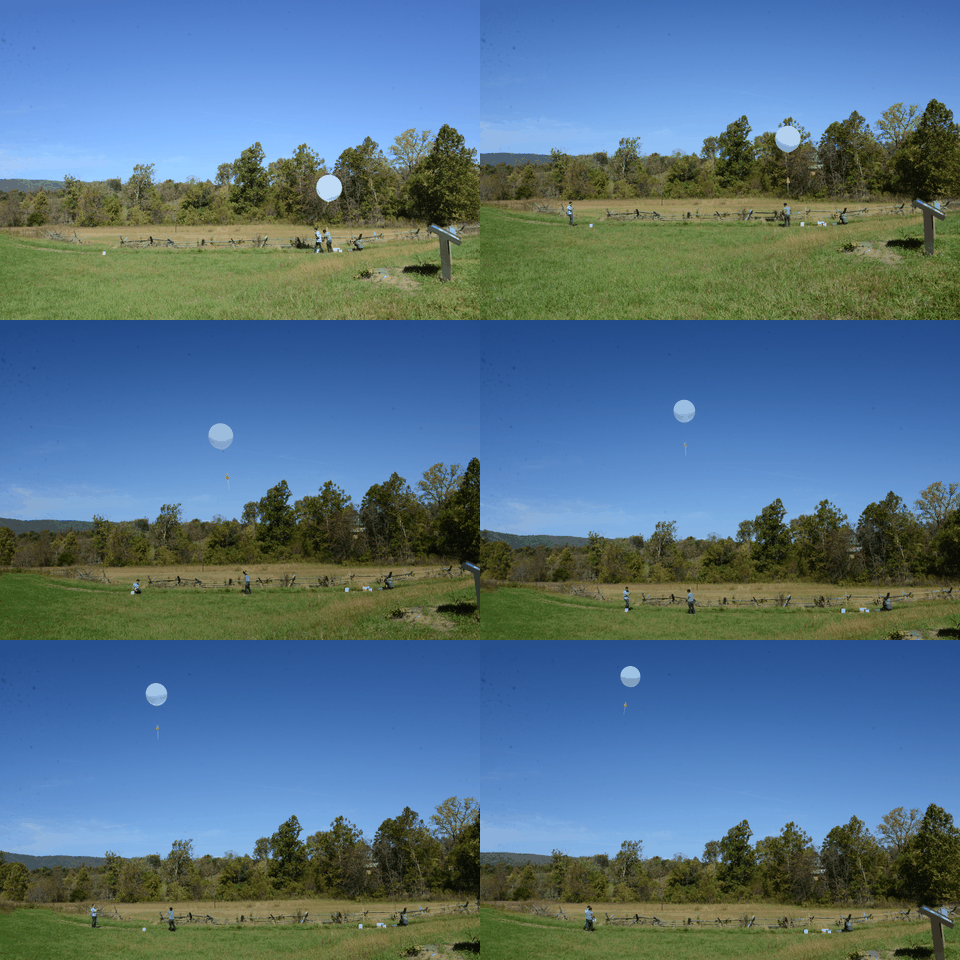
Launch_Walkout_Time_Lapse_Small

Launch Log

Time of Launch: 12:26PM EST Launch Coordinates: 38.9896069,-78.4169555 (601 Battlefield Rd, Fishers Hill, VA 22645)

Time of Recovery (in-hand): ~2:30PM EST Landing Coordinates:38.6178,-78.5064 (3348 Mill Creek Rd Luray, VA 22835)


0 minutes: Godspeed, Dogeship-4!

https://www.youtube.com/watch?v=qWjSFiQWrAo

2 minutes: Initial SMS messages indicate a nominal ascent rate, in lines with our pre-flight predictions. SMS messages cease (as programmed) once the launch-detect algorithm detects the launch and puts the phone into Airplane mode. We’ll see you on the other side, Dogeship. 

5 minutes: Although we’re not receiving communications because of the phone being in Airplane mode, we can still see her! Looking out the moonroof, she is climbing strong (and also rotating pretty violently….).

10 minutes: Based on initial climb and pre-flight predictions, we anticipate possibly being able to drive underneath the point of burst. Although we don’t expect to see her, we figure we will drive to that point along the Shenandoah valley ridge and give it our best shot. Meanwhile, up at 13,000 ft. altitude...

https://www.youtube.com/watch?v=0srqlL6Zt14
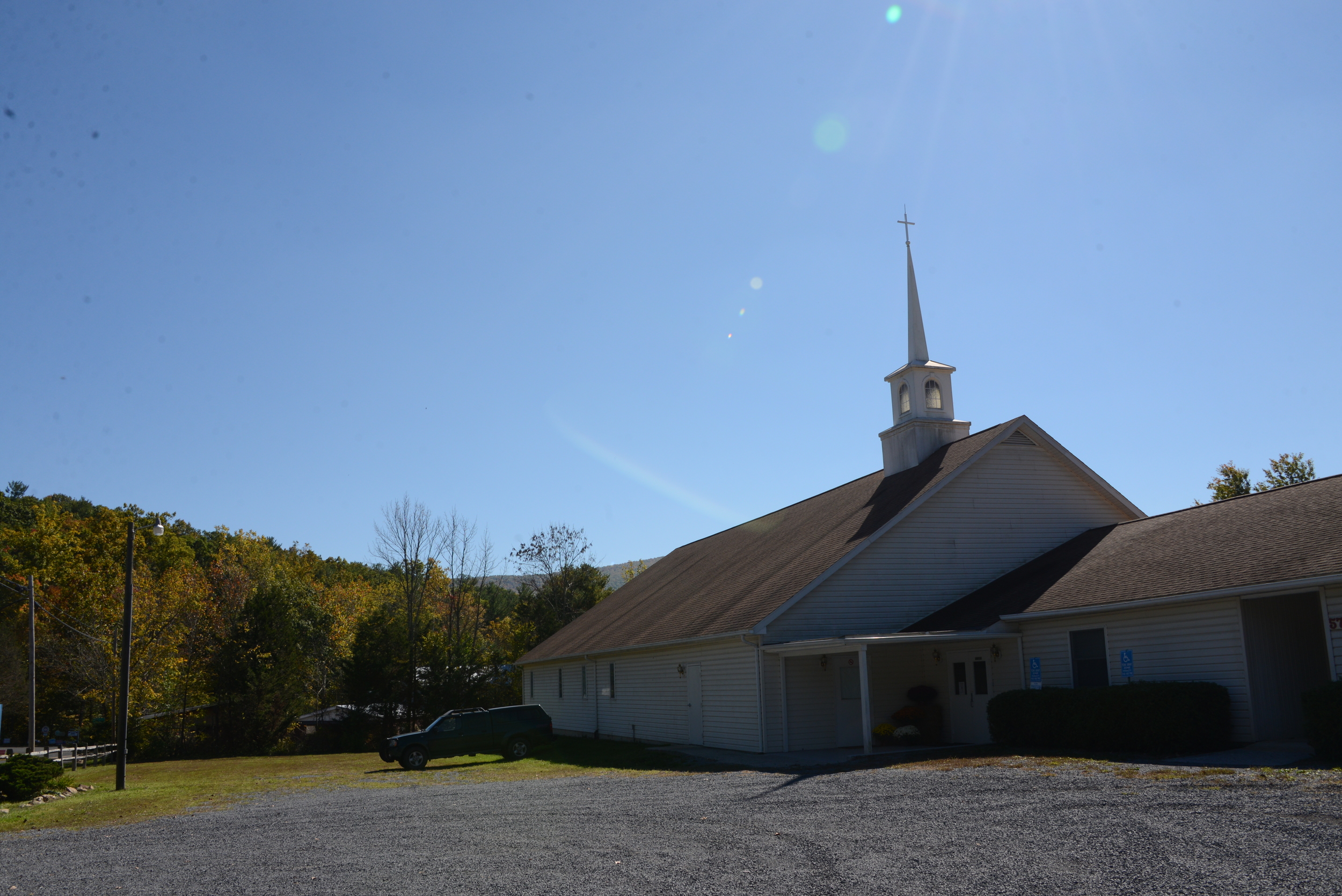
DSC_198025 minutes: We arrive at the intersection underneath the expected point of burst, and pull over in a Church parking lot. Again, not expecting to see anything (but still desperately hoping so), we hang out here for roughly 10 minutes. Updated in-flight predictions show that she may actually be going a little more north (towards the left of the Church in the picture), and unfortunately not traveling as far as we originally predicted. We decide to drive slightly north to see if we can scope out the area.

It's around this point in time when both the Riorand Camera and the Canon camera videos stopped. The Riorand froze most likely due to overheating (still powered up upon recovery), while the Canon camera likely froze due to the cold. Here is the entire ~24 minutes of flight looking up from the payload at the balloon. It's a violent flight, so hang on!

https://www.youtube.com/watch?v=17Zqec1P-_g

40 minutes: Landing zone assessment: not optimal at all. Trees everywhere! And worst of all, absolutely no cell phone service. If the updated pre-flight predictions are correct and she ends up landing short along the ridge, it is starting to appear that our chances of recovery (and of even hearing back) are pretty slim.

50 minutes: Because we have no cell service, we decide to drive to the top of the ridge. What a view! The beautiful fall foliage overlooking the valley almost makes us forget about how grim our prospects are starting to look for a successful Dogeship-4 recovery (almost).   

60 minutes: With a few bars of service on the top of the ridge, we still haven’t heard anything from our Dogeship. Expecting to have heard back for nearly 10 minutes but not receiving a single text and fearing the worst, we decide to take a hike up the trail on the ridge.

DSC_2003

80 minutes: Long past when we expected to receive an SMS and hanging on to what little thread of hope remained for a recovery, we finally get a GPS coordinate message! She just cleared the landing altitude detection threshold...she’ll be on the ground in only a few minutes, and is only a 20 minute drive from us (within 2 miles of where we originally anticipated the landing). Quickly abandoning our hike, we run back to the cars and get underway.

93 minutes: En route to the landing site, EFT-4 touches down. The location is in Luray, VA on a farm, smack in the middle of a field. With enough distance to the nearest tree line, we’re sure we’ll be able to pick her up, so long as someone is around that allows us on to their property.

120 minutes: After approaching the owners of the farm, we walk out to the field, and pick up Dogeship-4. The Canon camera still has the lens out but is obviously frozen in that position and no longer taking pictures, while the RioRand camera appears a bit foggy, but still in-tact. SUCCESS!

After a quick thank-you with the farm owners, we embark back to a surrounding town for some celebration BBQ.DSC_2052

Conclusions:

Overall, EFT-4 was a complete success. The balloon ended up landing within 2 miles of the predicted landing zone, we recovered the payload in just over 2 hours after launch, and we got some useful video on ascent. Thank you to Shaheen and Billy for their help on this successful EFT-4 launch!
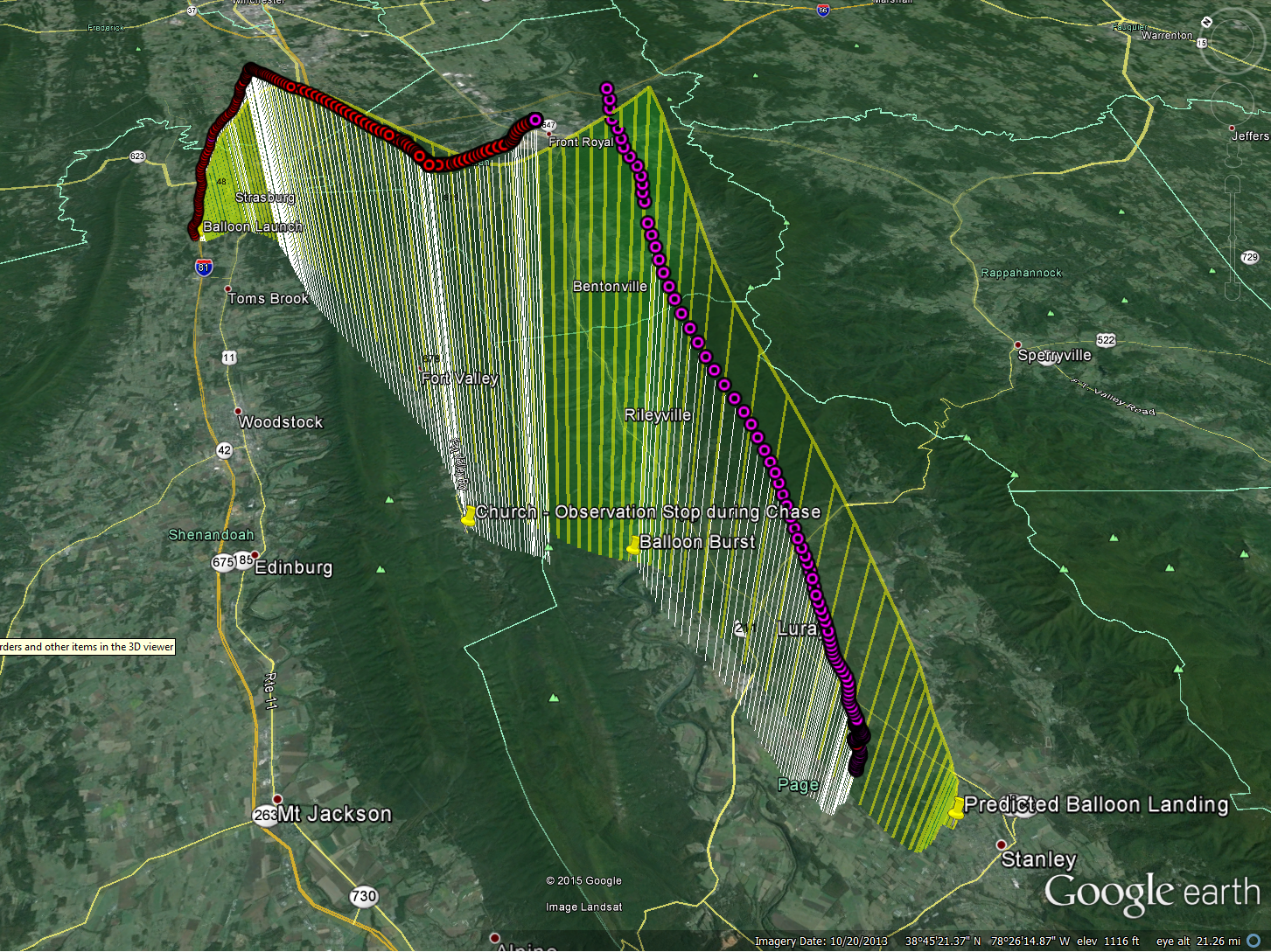
EFT4_Predicted_Actual_Compare

As with each of our launches thus far, we had a lot of learning and takeaways from this launch. Although we obtained video during ascent, both cameras failed roughly 20 minutes into flight (one overheated, one froze).

Flight Hardware Lessons Learned:

  • Camera condensation started on the ground before launch and during climb on the inside of plastic camera case. We suspect that the temperature inside the case rises before launch, causing an increased dewpoint, resulting in condensation on the inside (small hole also drilled on side for charging port)
    • Potential Mitigation: On future launches, using a small dessicant pack inside the camera case and better thermal control to prevent over-heating (or not using a case altogether)
  • Thermal Control - 2 Hot Hands handwarmers were used. It resulted in the payload becoming very hot (likely the cause of GoPro shut-down). Sitting on the ground 30-40 minutes in the sealed Styrofoam cooler before launch contributed to the over-heating issue.
    • Potential Mitigation: Active thermal system controlled by the phone; better control over the amount of time handwarmers are in the sealed payload.
  • Rotation: watching the live videos for the first time (we have only received still images in the past), we notice a high frequency rotation  and lower frequency but violent nutation (coning) on ascent.
    • Potential Mitigation: Likely caused by a combination of factors, including fast climb velocity (over-filled balloon to burst earlier than typical), single-point string attachment to the payload. We plan to analyze these causes in more detail and can experiment with the variables on future flight to determine root cause and get a more stable platform.

Other Lessons Learned:

  • Our previous EFT-3 launch seems an outlier for burst altitude. EFT-4 burst altitude was above 60kft and seems in line with expectations before EFT-3.
  • Our devices didn’t have service/data and so we were not able to verify that SMS was enabled and working prior to launch. We plan to add audible beeping in case service goes out before launch (after payload is sealed).

Doubling Down on Doge - Engineering Flight Test (EFT) 4

eft4_2.png

Our fourth Dogeship launch went up over Virginia this past weekend, racking up a second successful flight!  The Doge appears to have attained an altitude of roughly 65,000 feet with a flight time of one and a half hours.  The winds were light on launch day, so the total distance traveled was roughly 26 miles through the Shenandoah Valley.  A more thorough post of the flight will come in the next few weeks after we've gotten a chance to analyze the data. EFT4_KML

For this launch we attempted to fly two video cameras - one knockoff Go-Pro which was cheap enough to be considered expendable, and our trusty Canon digital camera which was space qualified on EFT3.  Unfortunately the videos all terminated after around 25 minutes of flight.  The Canon, mounted on the outside appears to have frozen.  The Faux-Pro was inside the Doge and overheated due to the heat of the hand warmers.  One major observation was the recurrence of a high frequency rolling motion of the payload combined with a downright violent spinning of the entire system during the climb.  Once we post the video this will become immediately apparent - it'll make you sick!

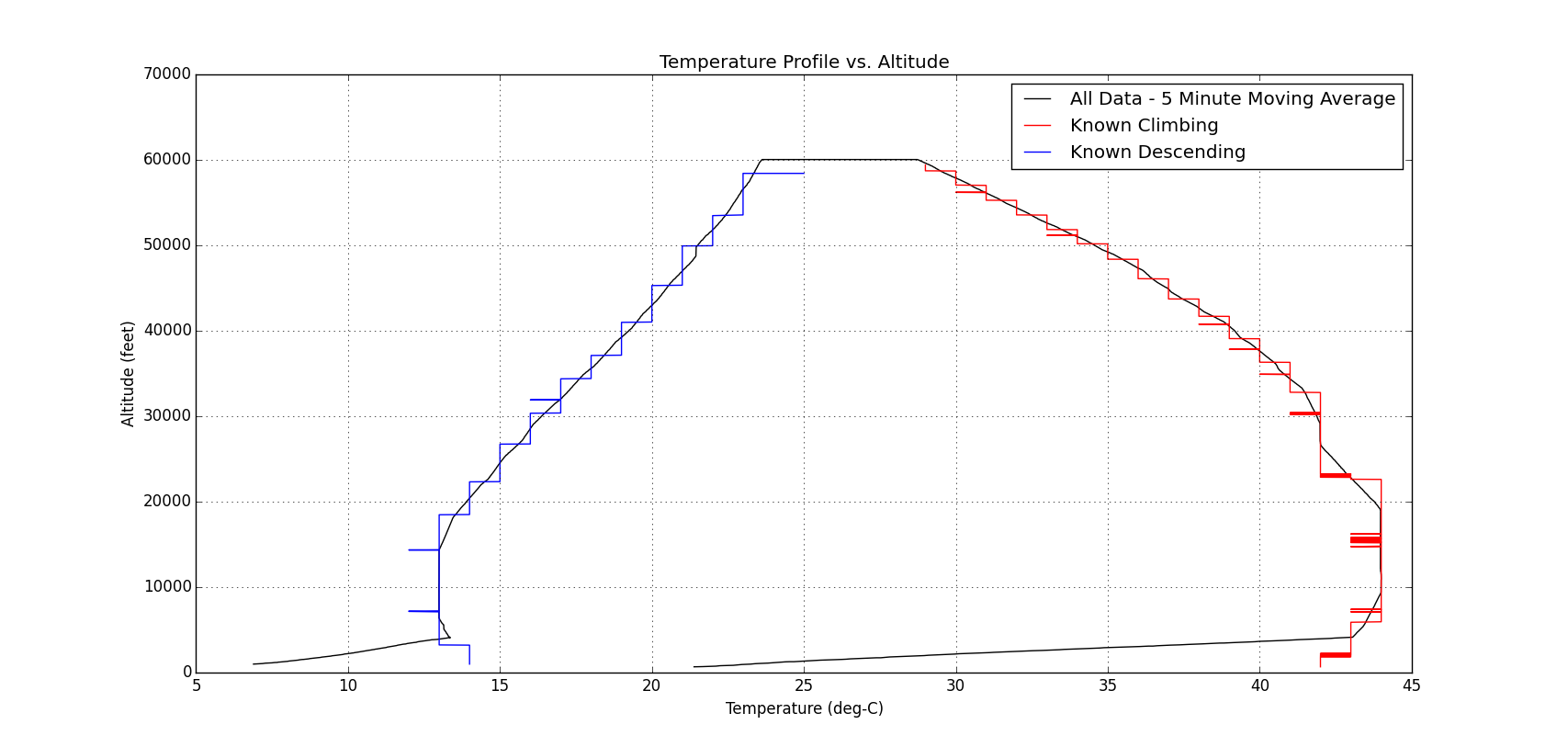
Temp_EFT4

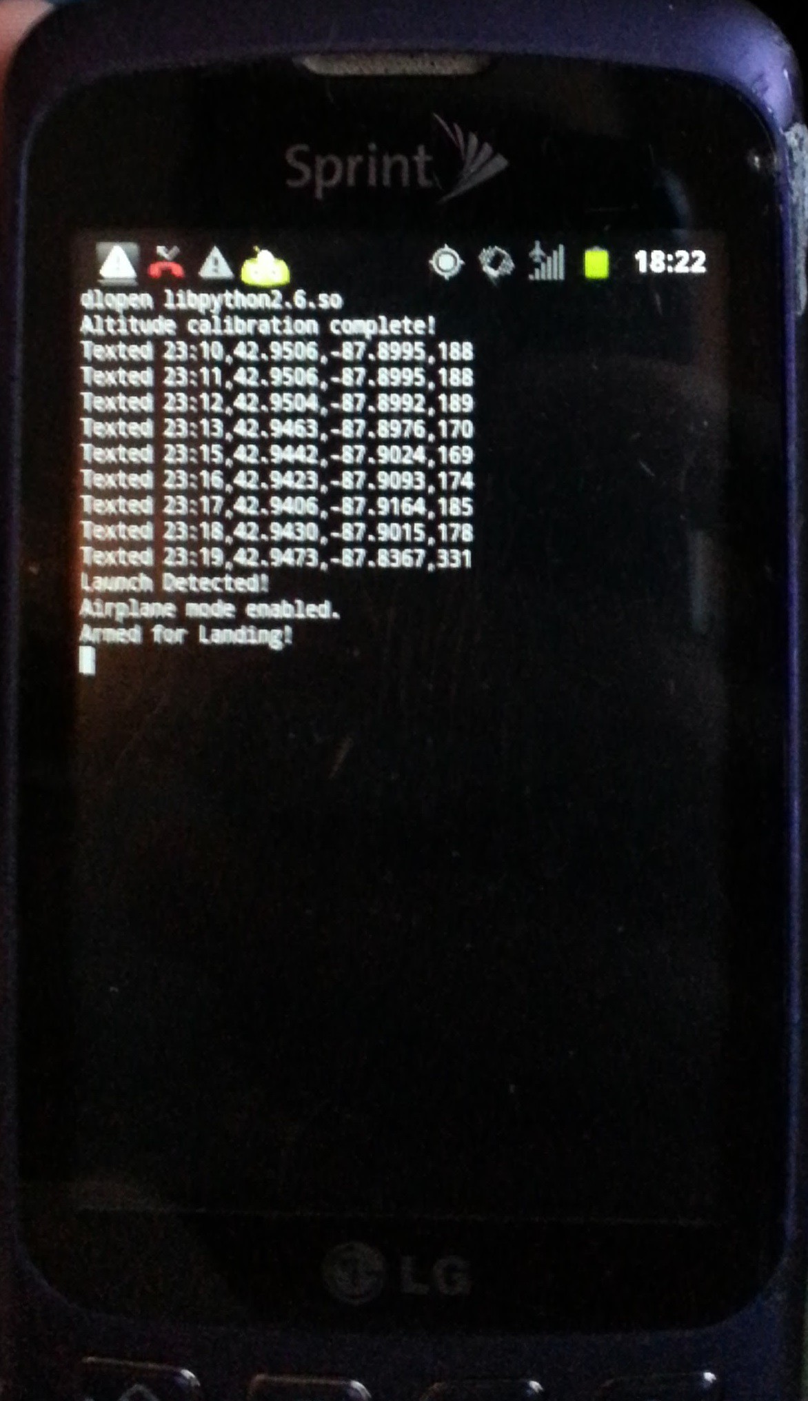
Many more lessons learned on this flight, but the big success was the second flight of the telemetry tracker, and the first flight with our enhanced mission code, which is just begging for a future blog post.  This system is smart enough to detect launch and land, and has a number of fault codes that trigger various actions to attempt to provide locations in the event of an in-flight emergency.  More on this one to come soon.

20151004_182217

The Doge has Landed! - Engineering Flight Test (EFT) 3

img_4577.jpg

IMG_4030Date: 14 March 2015Equipment:  DS Rev 3 (aka Dogeship-3) Launch: Greensboro, NC Landing: Warrenton, NC Time of Flight: 89 Minutes Distance Travelled: 91 miles Burst Altitude: TBD (~61,000 ft)

After our first successful balloon launch with EFT-2 (still to be recovered), plans for EFT-3 were immediately underway with great enthusiasm and vigor. The biggest planned improvement (aside from launching in a warmer location) to the hardware arsenal for EFT-3 would aim to prevent the payload from getting stuck in the tree, by means of a “cut-down” circuit.

20150304_182256

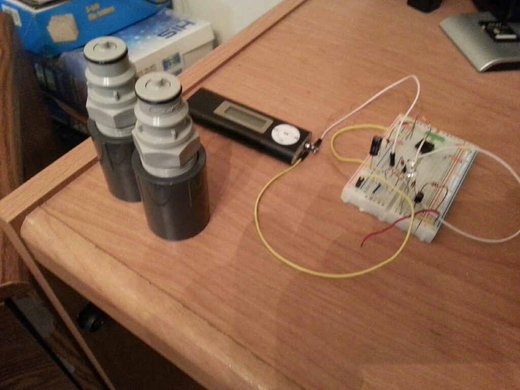
The thought of the cut-down circuit would be to attach the payload to the parachute via a single string, and activate a mechanism which would sever that attachment and allow the payload to fall from the tree while the parachute remains suspended in any branches. The original concept would use the phone as the activation mechanism. By playing an audio signal (none other than the Star Spangled Banner for us) from the phone, it would trigger a signal in a circuit and trigger a relay to dump current from a small battery through a piece of Nichrome wire. The hot Nichrome wire would melt the attachment to the parachute, and voila! The payload would fall from the tree. Unfortunately, the cut-down circuit was abandoned last-minute due to insufficient time for prototyping and getting the circuit ready. However, there are plans to use the cut-down circuit as a means for delaying the deployment of the parachute on descent in the future to further reduce mission distance.

IMG_4527

In addition to the cut-down prototype, we were ready to try for a higher altitude in order to capture more spectacular pictures. The Kaymont 600 balloon has a published burst altitude of 75,000-90,000 feet. The plan was to fill it with an entire 125 cu ft. tank again, which is an overfill condition and would result in a pre-mature burst altitude somewhere below the published burst altitude, but would allow us a shorter driving distance for recovery.

The last major detail was planning the location. Priority 1: it should be warmer than the first two launches. Priority 2: again, let's do a warm launch! The team decided to take a flight to Durham, NC to visit a family member currently attending Duke University there and launch in North Carolina (warm!).


Pre-Flight

The launch date was selected for the March 13 weekend and plane tickets were booked. A Test Readiness Review (TRR) meeting was held again 1 week prior to ensure that nothing was overlooked and that the pre-flights were completed and go/no-go launch criteria established.

EFT-3_Pre-Flight_Predictions

Mission Objectives

Primary Objectives (Mission Critical):

  1. Verify Telemetry (TM) system utility, including collection of lost frames
  2. Verify Payload Cutdown System
  3. Verify validity and assumptions of flight simulation using TM and Flight Data Recorder (FDR) data
  4. Finalize TRR, Preflight, and Launch Procedures
  5. Optional Objective: Record photos during ascent and descent

EFT-2 Flight Hardware

The hardware configuration for EFT-3 was exactly the same as with EFT-2, with the exception of using a smaller parachute for a faster descent, and a Kaymont 600 balloon instead of a 350 for additional altitude before burst. The cell phone was a different model, but served an identical purpose by running the latest TM software for EFT-3.

Risks

In addition to much more rigorous flight planning, the highest risks for EFT-2 were determined as outlined in the chart below. The cut-down device had been originally planned to retire the "tree landing" risk, but had to be abandoned last minute due to lack of testing.EFT-3_Risks

Telemetry

The Telemetry (TM) software was updated for EFT-3 to allow for a few improvements and to test some theories for future flights.

Mainly, the TM software was updated to be able to receive commands once back on the ground, to allow for changes in the message length, the frequency of which messages are sent, and a few other parameters. The software also accepts the “sever” command for the cut-down mechanism, which may prove to have use in future flights as a cut-down or parachute delay mechanism.

Launch Day

Parameter Imperial S.I.
Final Payload Weight  1.8 lbs. 0.8 kg
Measured Nozzle Lift  6.2 lbs. 2.8 kg
Free lift (Nozzle lift – payload weight)  4.5 lbs. 2.0 kg
Estimated Burst Altitude 79,000 ft. 24,000 m

IMG_4188

Launch Log:

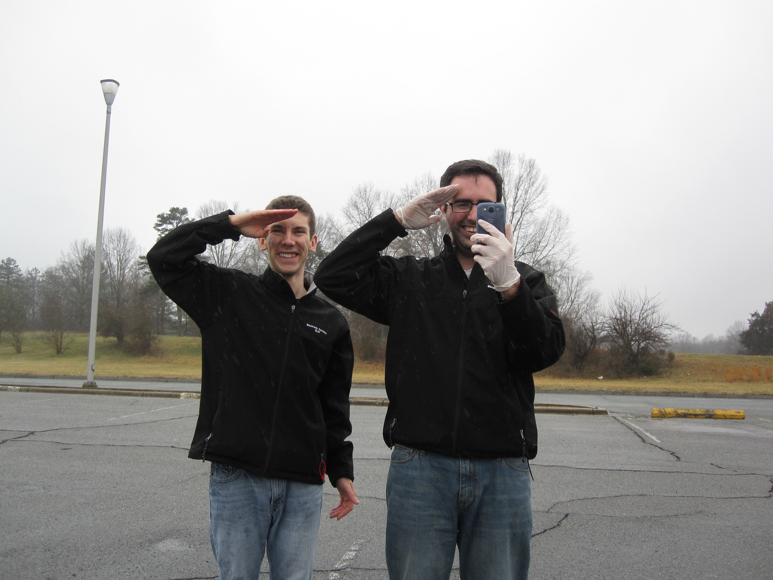
0 minutes – with a small speech and the dual-salute, EFT-3 is sent off. She disappears into light mist falling from the thick clouds. We flew down to NC for this; we weren't about to scrap our launch just because of a little rain!

1 minutes – Communications have already ceased. Although not unexpected this flight, we had hoped to maintain communications a little longer before losing contact. A plot of temp vs. time shows that the temperature is much more reasonable with 2 hand-warmers. And now we wait.

IMG_419075 minutes – modeled landing time. Still no messages have been received.

90 minutes – CONTACT. EFT-3 is on the ground in the middle of no-where. She appears to be right on the fringe of what appears to be a grove where very tall trees meet some very short bushes.  We route towards the landing zone and wishfully hope that it is in the small bushes…

100 minutes – our team parks at a Methodist Church just outside the tree farm. After 20150314_162628reading the posted signs that just forbid firearms and hunting on the land without a permit, we proceed to walk the mile or so towards EFT-3. SMS messages are still coming in loud and clear.
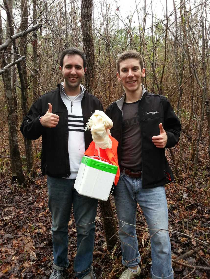
As we proceed along the banks of a small stream, we near the location where the EFT-3 TM beacon has been emitting from. Tall trees on our right, but small trees to our left….still praying that EFT-3 landed a little to the left.

120 minutes – we see her, and she’s on the ground! After de-tangling the lines from thorn bushes, we start the trek back out.


IMG_20150314_162851

Conclusions:

EFT-3 marks the first successful recovery of a launch, including access to both the FDR data and camera pictures. Although it appears that the balloon may have burst earlier than anticipated (even for the overfill condition), the descent ended up going much longer than expected, so we lucked out in not having it go as high as it could have.

EFT-3_GPS_Data

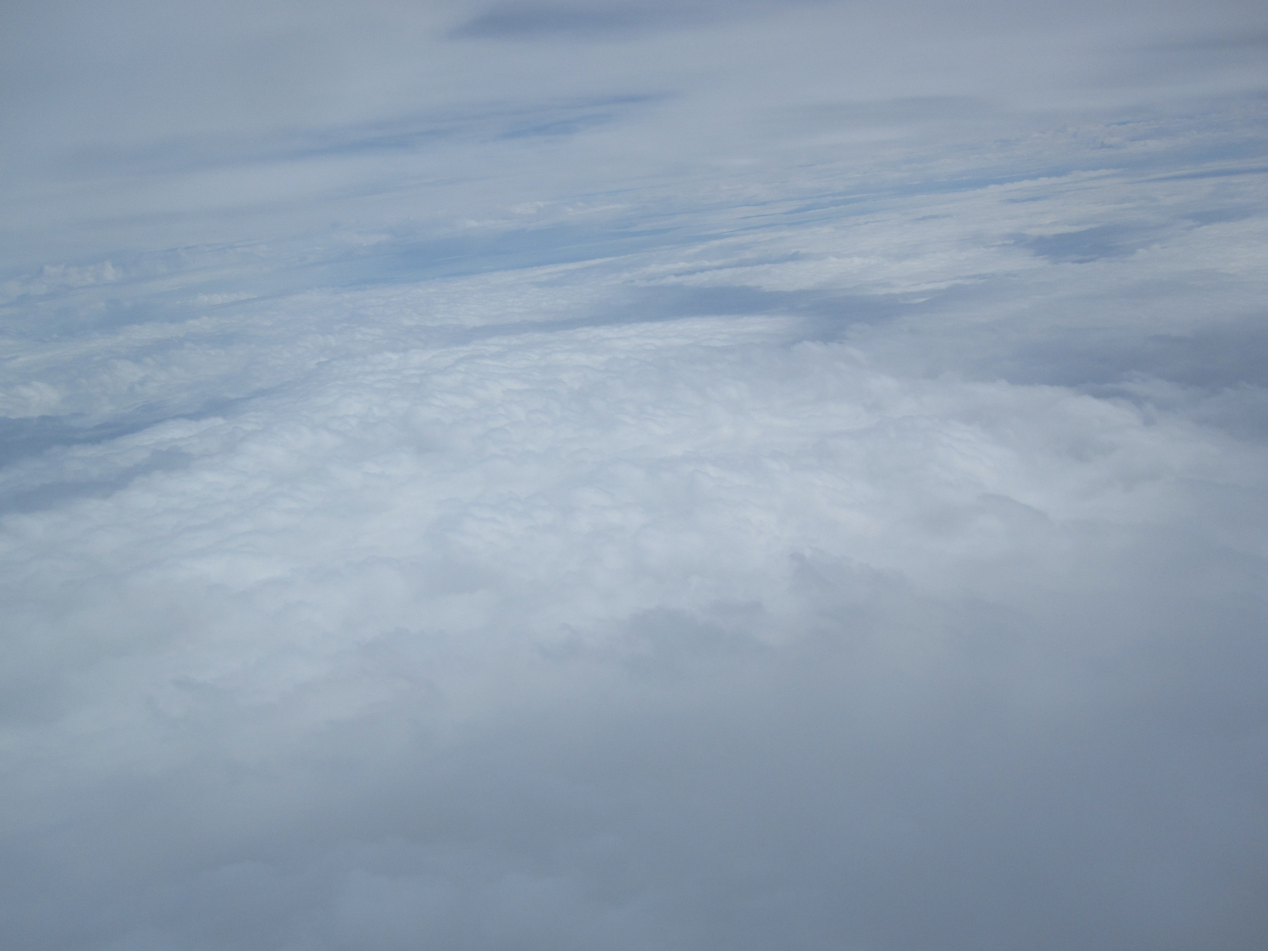
The pictures up at the high altitudes indicated that the payload was experiencing severe sway, potentially flipping end over end at times. It is also worth noting that IMG_4331the balloon to parachute attachment line had wound itself around the parachute suspension lines about half way up, which effectively reduces the line length and hence reduces the drag coefficient of the parachute. For future launches, a longer balloon to parachute attachment line should help increase stability, and hence make it more stable on ascent. Furthermore, a parachute deployment mechanism (potentially utilizing the cut-down device hardware) that waits until a prescribed altitude before deploying the parachute would decrease the changes of any lines tangling and reduces the distance and time that would be required for recovery.
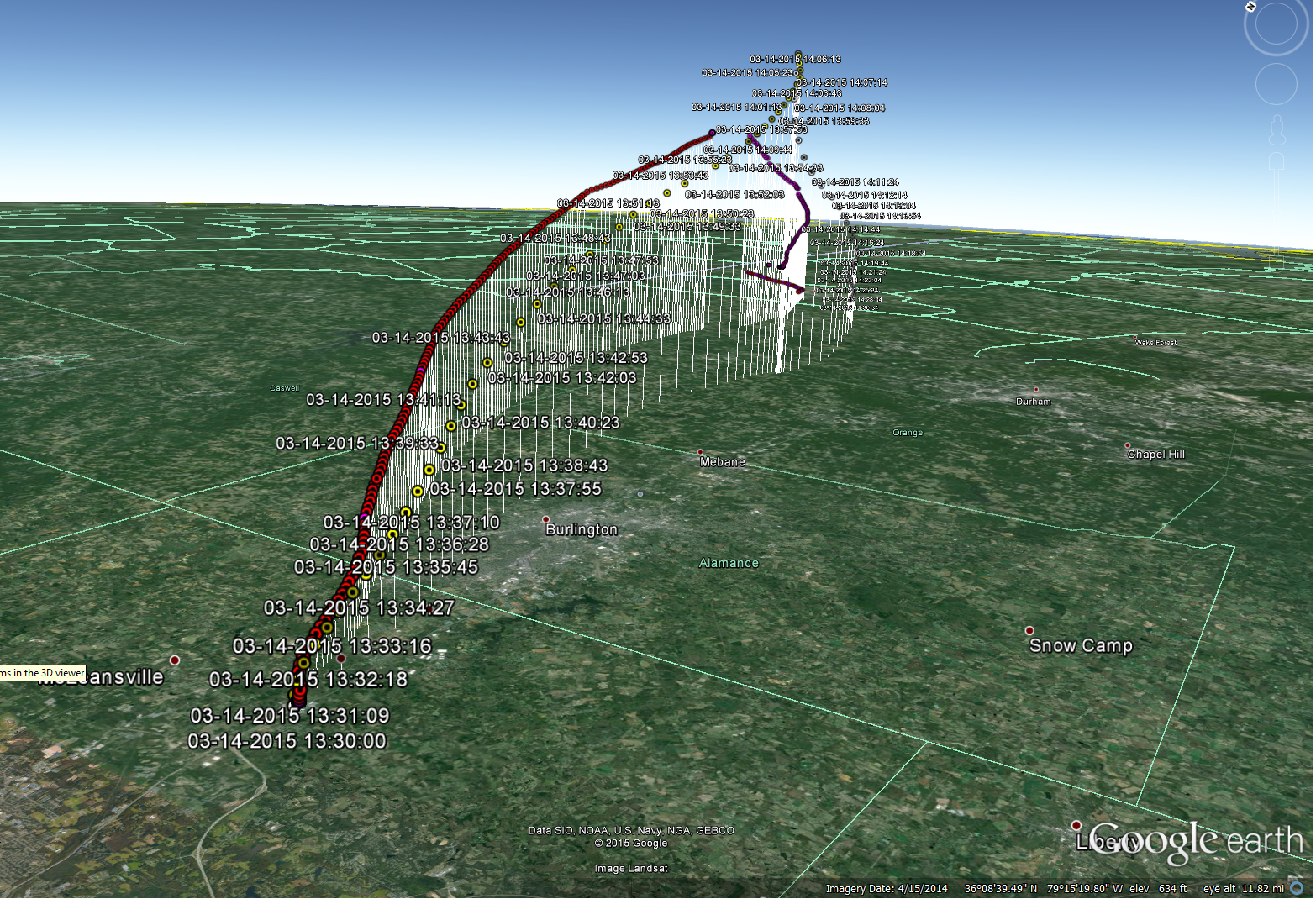
Compare_EFT3_Predict_Actual

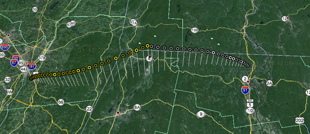
Comparison of the actual GPS (red) with pre-flight predictions (yellow) show good correlation with winds, taking into account earlier than expected burst of actual system.

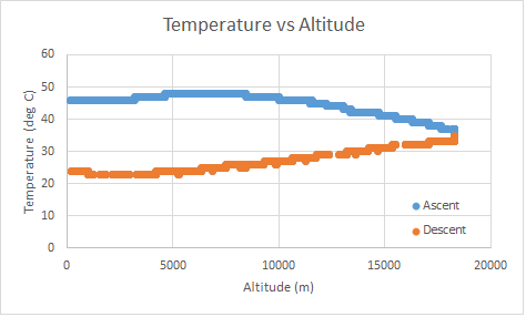
For those interested, the plot of temperature vs. altitude shows that our hand-warmers and cooler insulation design maintained the cell phone temperature within a desirable range for the duration of the flight.

Temp_vs_Altitudepng

The Most 1337 Doge Yet - Engineering Flight Test (EFT) 2

Date: 10 January 201520150110_094103Equipment:  DogeShip Rev 2 (aka DS-2) Launch: Albany, NY Landing:  Nashua, NH (targeted), Bernardston, MA (actual) - [More on that “near miss" later] Time of Flight: 84 minutes Distance Traveled: 62 miles Burst Altitude: TBD (~56,600 ft) Payload Status: Still in a tree...

With one launch under our belts, but the hardware being several hundred miles out at sea, we were determined and eager to head back to the skies as soon as we could reasonably determine the root cause of the failure on EFT-1. After analyzing the Telemetry data, we were able to tweak the input parameters in our Python flight simulator model, and obtained our best educated guess as to demise of the ill-fated EFT-1.

Despite the bone-numbing, frigid conditions of our first launch back in November, here we were again packing the car at 7AM in balmy 3F conditions. After having driven out to Albany, NY the previous night to crash at a friend's apartment, the car was packed and we embarked for the launch site.


Launch Plan:

With a planned launch date of January 10th, the winds for the weekend necessitated a trip out to Albany, NY for an estimated recovery around Nashua, NH. Parametric studies were run for various configurations of nozzle lift (total lift minus the weight of the balloon), weight, and descent drag of the parachute to ensure that we would have all the information necessary on launch day to bound our predictions.

EFT2_1

Mission Objectives

  1. Verify Test Readiness Review (TRR) and launch procedure effectiveness
  2. Verify Telemetry (TM) system utility and reliable recovery techniques
  3. Verify validity and assumptions in Python flight simulation using TM and Flight Data Recorder (FDR) data
  4. Verify utility of the common fill/mounting system
  5. Optional Objective: Record photographs during ascent and descent

Risks

In addition to much more rigorous flight planning, the highest risks for EFT-2 were assessed and ranked to maximize the probability of success.

EFT2_2

Both the cell phone life at cold and cell phone coverage at the landing zone were the highest impact risks, since either occurrence would likely mean we would not be able to find and recover EFT-2. Lesser risks included flight sim model inaccuracies resulting in an uncertain landing location, and the very high probability that EFT-2 would land in a tree and could be found but not easily recovered.


20150105_234117

Telemetry

Similar to EFT-1, the Telemetry (TM) phone would act as a Flight Data Recorder (FDR) in-flight by recording accelerator data, temperature, GPS, and much more for us to analyze. In terms of recovery, the phone would send us an SMS text message once back on the ground in order to locate the payload for recovery.


Launch Execution:

20150110_094110After final pre-flight checks the night before (OK, maybe it was 2AM the morning of...), the launch-site selected was at a school just south of Albany, NY, ensuring that we were outside of controlled airspace and not in line with any of Albany’s runways.

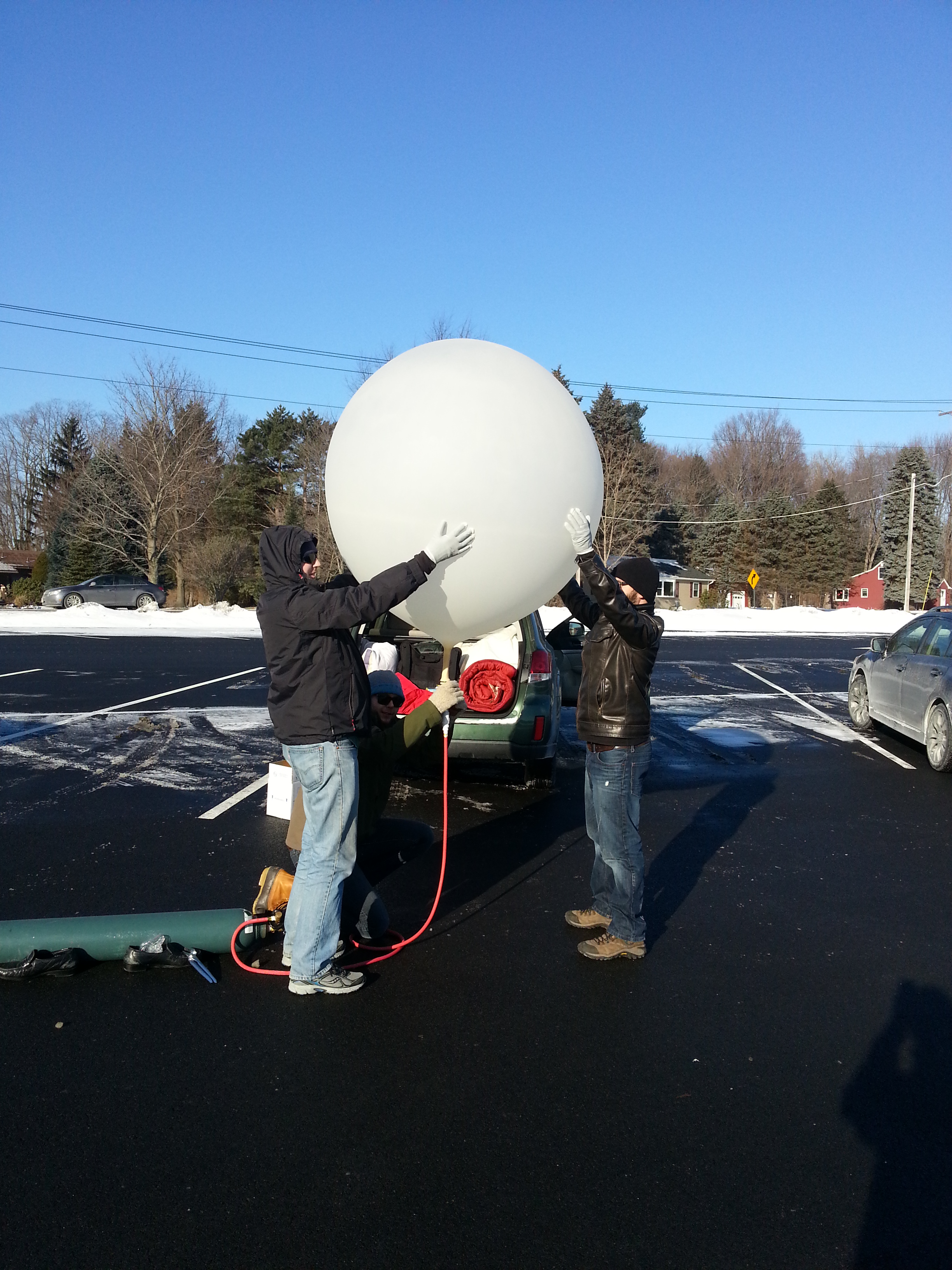
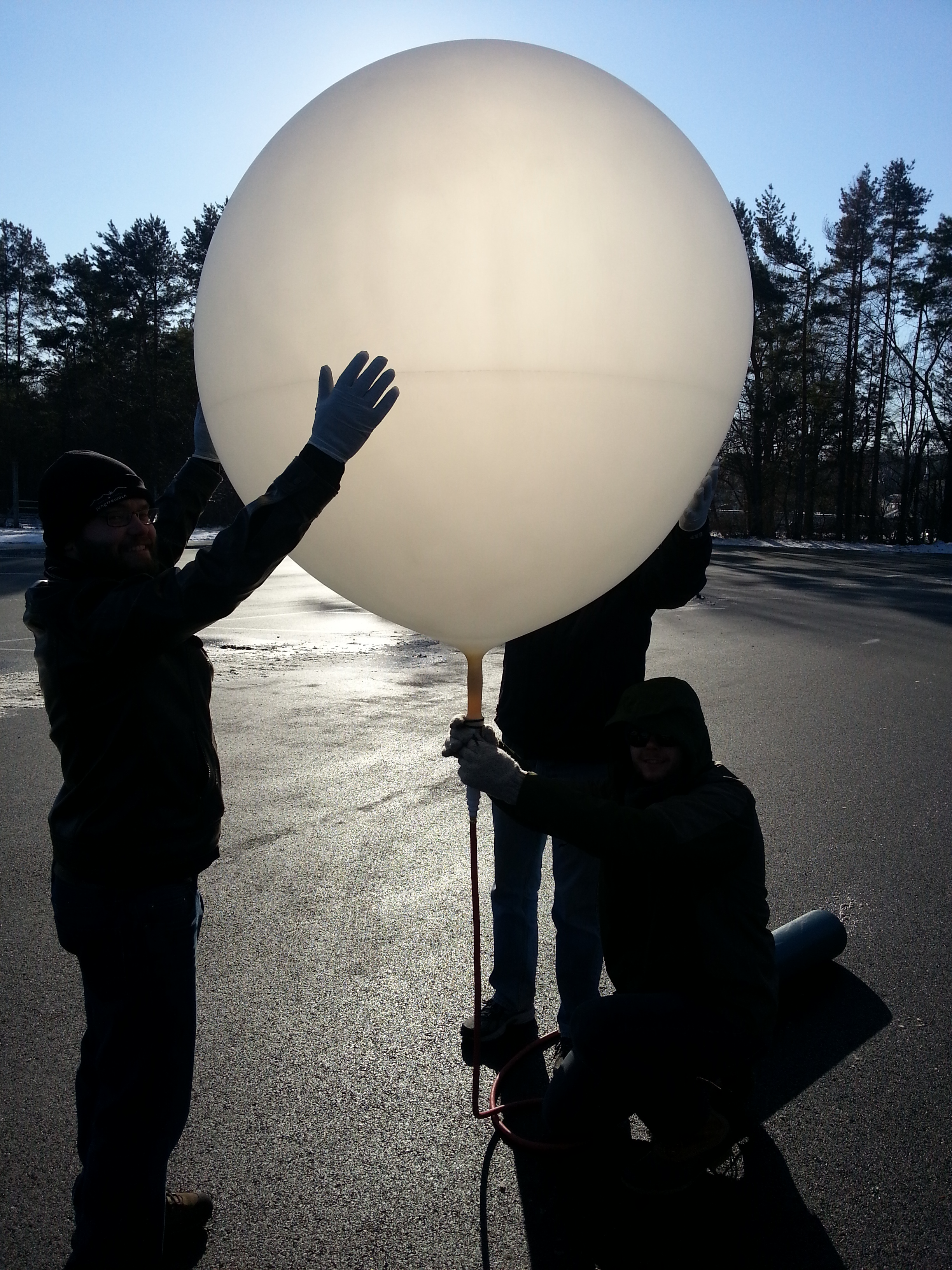
A team of five people were present to help out, which proved invaluable since the temperature was a frigid 10F at launch, and the extra help allowed us turns to swap out and warm our hands.

20150105_191757

The QuikFill inflation system worked wonders! A quick attach/detach allowed for periodic nozzle lift checks, and the direct attachment to the CGA-580 valve on the helium tank meant there was no chance of any Helium leaking during the fill.

After preparing the payload, enabling the TM phone, and completing the filling of the balloon, the initial launch parameters were recorded and EFT-2 was determined a GO!

Parameter Value Units
Final Payload Weight 1.5 Lbs.
Measured Nozzle Lift 7.2 Lbs.
Free lift (Nozzle lift – payload weight) 5.6 Lbs.
Estimated Burst Altitude (GPS data not yet retrieved) 56,600 ft


Launch Log:

0 minutes – and she’s away! Godspeed, EFT-2.

https://www.youtube.com/watch?v=K6OI5Xx3cDM

2 minutes - with the balloon climb rate seeming to be on target, the first few minutes of the launch seemed to bode well for EFT-2.

3 minutes - communications unexpectedly cease.

Noticing how the temperature had been slowly creeping up over time from 25C all the way to 50C at our last telemetry response, a sinking feeling developed in our stomachs (and yes, we did in fact just switch to SI units...much more useful when doing anything except describing the temperature outside!). Pre-flight testing with the TM phone indicated that it would shut-down due to overheating somewhere around 56C. Is it possible that the phone shut-down and EFT-2 would suffer the same un-recoverable fate as EFT-1? Only time will tell.

60 minutes - still not a single comms message has been received since 3 minutes. Powered off a mix of caffeine and adrenaline, we frantically continue monitoring for any sign of the Dogeship, but concerns continue to grow that the phone shut-down due to over-temp and that there will be no way to find it once she lands.

75 minutes - if the balloon burst as expected and the flight simulator was accurate, EFT-2 should be landing at any moment. Every agonizing minute that goes by suggests more and more that we won’t be hearing again…

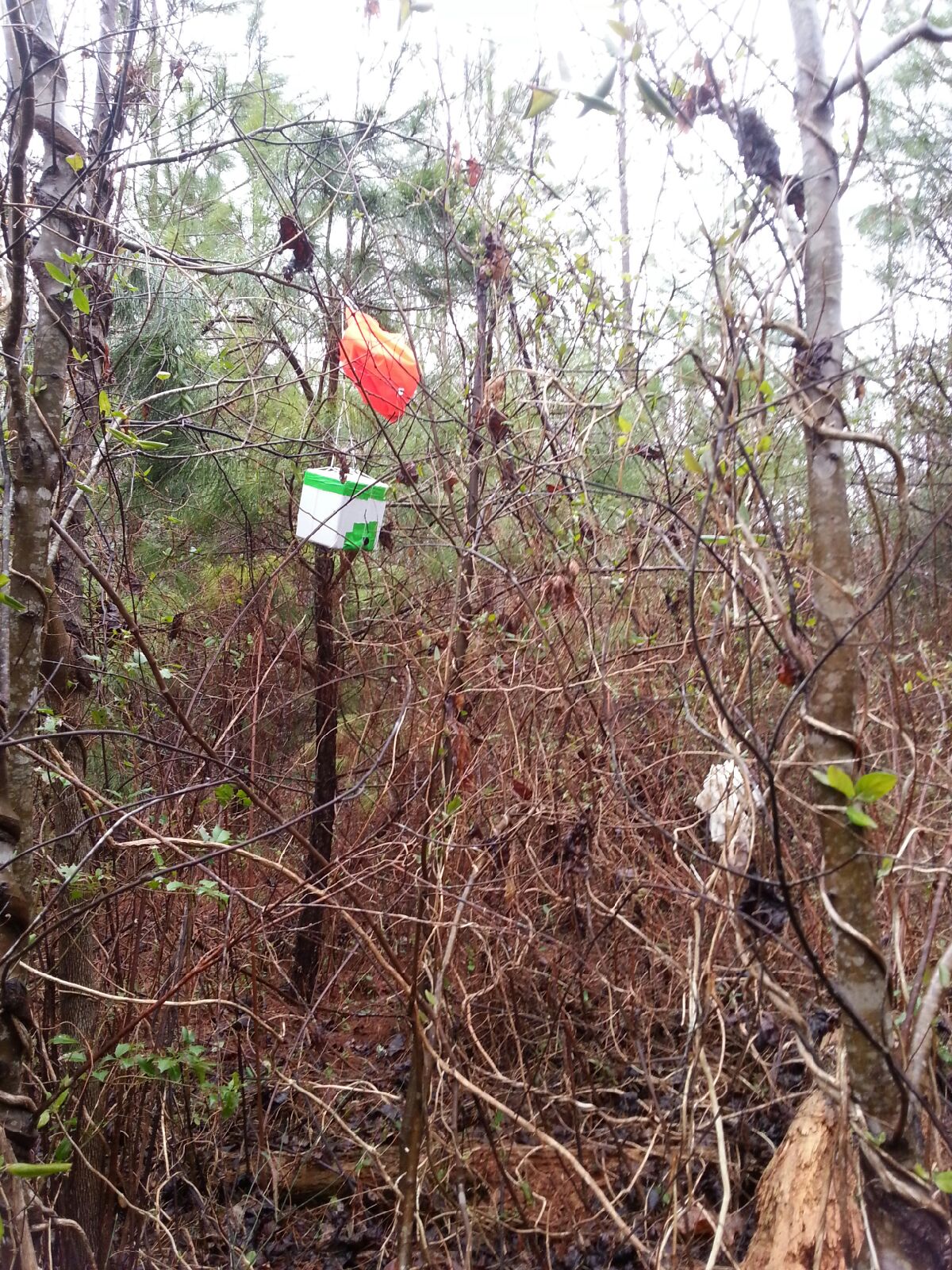
See the orange thing in the tree? Neither could we. No idea how we spotted it from the road!

84 minutes - CONTACT! SMS messages with GPS coordinates have been received, and EFT-2 is on the ground in Bernardston, MA (Zip code 01337 – yes, 1337). Re-route the car GPS and off we go to shoot up Rt. 91 from the Mass Pike.

90 minutes - only miles away from EFT-2, a major accident on the highway has traffic backed up for miles, and we’re caught right in the middle of it. Excited yet frustrated that we aren’t moving faster, we press on.

120 minutes – we arrive at the site, and spot something orange from the road. It’s a decent way in on someone’s property. Knocking on their door, we obtained permission to take a closer look and headed out to find EFT-2.

Unfortunately, EFT-2 will not be recovered today (or any time soon). She’s 80+ft. up in one of the tallest trees amidst branches.  Stay tuned for updates on the recovery efforts thus far and the one planned that will hopefully bring her down.

EFT-2 Postflight Predict


Conclusions:

20150110_101042

Overall, EFT-2 was a giant success, despite the fact that she is still 80 ft. up in a tree in Bernardston, MA. All primary objectives were accomplished, and the tree landing was not unexpected, as predicted by our top pre-flight risks.

On future flights, it will be expected that we will lose communications after takeoff, but that the FDR will record all the data for us to recover after, and that the TM phone will prove a reliable location technique once the payload is back on the ground.

Also, we wanted to give a shout-out to the awesome launch crew that helped us out: a huge thanks to Dave, Andrey and Brian for helping with the launch!

The Doge Seen Round the World - Engineering Flight Test 1 (EFT-1)

featured.jpg

DS1_In_FlightDate: 28 November 2014Equipment:  DogeShip Rev 1 (aka DS-1) Launch: Ludlow, VT Landing:  Nashua, NH (targeted) Time of Flight: >2, < ∞ hours Distance Traveled: >200 miles Burst Altitude: Unknown Payload Status: Likely floating off the coast of Nova Scotia

I vigorously rubbed my hands together to stave off the frigid winds of a late November Vermont - the weather forecast had called for clear skies and calm winds, but the reality that we came upon was far from it.  To my left Brian knelt in a freshly plowed parking lot, holding a rapidly expanding weather balloon whipping around dangerously in the wind.  This stage of flight is the most dangerous for the mission - one wrong gust of wind could cause the balloon to bend too severely and break or, worse yet, be torn from our hands, doomed to a quick climb with our payload still on the ground.  I was working quickly to prepare our payload for its voyage into the upper reaches of Earth's atmosphere, working against the clock to release the balloon as soon as it was inflated and with enough battery to last to landing.  We were confident in our planning - our first launch will be a success!

Mission Objectives:

  • Launch a weather balloon and payload into (near) space
  • Verify telemetry - a signal to get information about the spacecraft - works and is useful
  • Recover the spacecraft

Our goal was and still is to be able to reliably launch a space balloon on a small budget, aiming to develop a machine that could be launched by anybody who truly wants to.  The culmination of a few months of research and planning resulted in this launch of what has come to be called the DogeShip-class spacecraft.

The Doge is a rugged and simple ship made of completely 'off the shelf' parts.  The system is essentially a cell phone placed into a cooler with a camera duct-taped to the side.  The cell phone is running a Python script which report back the balloon’s current position and altitude.  Additionally, the phone acts as a flight data recorder (FDR), saving off position, altitude, time, acceleration, and magnetometer information every second.  The hope is that the simplicity of the system, along with some pre-flight planning, would result in a reliable launch and recovery.

Doge


Launch Plan

The time it took to research, design, and build the first Doge led to an unfortunate launch time and location - November in New Hampshire, a cold and windy first space launch.  Launch Day was to be November 28th, 2014 with a targeted landing zone of Mt. Kearsarge State Park in New Hampshire.  We picked that landing zone because it is a rural area where we would be less likely to hit someone's property, it has enough roads and hiking trails that we could get wherever we needed fairly quickly for recovery, and the mountain had a cell tower on top, ensuring a strong cell signal in the area to get a location text message back from the Doge.

During the days leading up to the launch, a major winter storm had hit the area and knocked out power to the majority of New England, adding more uncertainty to the launch.  The Doge was theoretically capable of flying in all weather, it looked as if we may be putting that to a real test.  A pre-launch analysis was done to find the launch point that would result in an impact at Mt. Kearsarge – Ludlow, Vermont

IMG_2663

Jumping out of the car into 10 degree temperatures we set immediately to work.  We had done a lot of thinking about what needed to be done and put together a pre-launch plan but as many know, no plan survives first contact.

The first problem we encountered was not understanding how the pressure regulator worked.  We had assumed that once you turn the gas on that it would start flowing into the attached balloon, in reality we were not provided a scientific pressure regulator but a party balloon pressure regulator.  As we troubleshot what was preventing the gas from flowing we inadvertently destroyed our filling system.  Once we figured out how to get the helium flowing (hint if you’re ever using this kind of regulator – bend the plastic protrusion to open the fill valve), we began filling the balloon at the maximum rate.

We encountered a second problem: our research indicated that filling the balloon would take 30 minutes – in reality it took 5!  Those extra 25 minutes were intended to prep the remainder of the payload and get the telemetry system working and validated.  I rushed around tying strings, shaking hand warmers to activate, and enabled the telemetry system, all while a 5 foot diameter, fragile balloon was blowing around in 10 degree winds.

There is an old adage that says that things happen in threes…  well this launch fell into that category.  Problem three - in ballooning, few numbers are more important than ‘Free Lift’.  Free lift is defined as the total lift produced by the helium minus the weight of the payload.  This number drives how fast a balloon will climb through the atmosphere which directly relates to how far it will go over the ground.  We had planned for a free lift of around 3.5 pounds and what we measured was actually 0.6 pounds – the Doge could barely pull itself off the ground.

This was a major problem – all of our preflight work was out the door and there was no way we were going to hit Mt. Kearsarge.  There we stood, a Doge fully primed and ready blowing in the freezing wind and having to make a launch or abort decision.  After weighing our options, we decided what the heck - we were there, we were ready, and we needed some practical experience and data.  Throw caution to the wind, its time to fly!


Launch Log

0 minutes - It's flying, it works!!  The balloon slowly rose into the sky, with the payload swaying underneath as it rose through the winds.  After barely clearing a hill, it rose out of sight as we packed.  So begins the chase.

https://www.youtube.com/watch?v=LU2TTTHtn3E

10 minutes - a quick stop for a warm up coffee allowed us a first look at telemetry being sent from the balloon.  My eager excitement quickly turned into shock – the balloon was not rising at the predicted 15 miles per hour, but at an anemic 3 miles per hour.  Seeing as it needed to get at least 10 miles high to burst, that put the minimum climb time at around 3.5 hours, 4.5 hours if we included the descent.  We all looked at each other and instantly had the same conclusion:  “She’s going into the ocean”.

30 minutes - a telemetry update showed that DS-1 was about to enter New Hampshire - we were about to have an inter-state spacecraft!  The balloon was barely crossing through 10,000 feet at its steady 3 miles per hour climb.

50 minutes - we have had radio silence for quite some time, but knew that the original prediction should have the balloon at roughly its peak altitude of 75,000 feet.  We got a sudden, single telemetry message – it was at 15,000 feet and 20 miles south of Mount Kearsarge, the planned landing point, and still climbing!  This spacecraft was quickly heading for a watery demise in the cold north Atlantic Ocean.  An updated prediction indicated a flight over Manchester, NH and the recovery team was once again re-dispatched.

90 minutes - after yet another period of silence, an unfortunate message was received.  The balloon was at 27,000 feet over Manchester, travelling at 60 mph in level flight.  We had what the weather balloon community calls a ‘floater’, a balloon that is neutrally buoyant and will not longer climb or descend.  One final prediction showed that the balloon would pass over Glouster, MA as it cruised out to sea, heading for the Atlantic Grand Banks.  This confirmed our initial assumptions from the coffee shop – DogeShip-One is heading for the drink.

130 minutes - This was the time that she was predicted to cross over the coast and head into the Atlantic.  We still had not heard a thing from the Doge since the last update over Manchester.  We were all hoping for a miracle reporting the Doge on the ground near the coast, but that was just wishful thinking.  We concluded that the Doge was lost, to be found one day by a mariner or a kid in Nova Scotia as a message in a bottle.  Perhaps one day we will get an email on our recovery address from somewhere in the world about a found Doge!

Trajectory_Google_Earth


Conclusions

The frigid launch of our first weather balloon was a massive learning experience.  We had gone into it with high hopes, but the expectation that there was a pretty good chance we would not get the balloon back.  Our main intention was to put a stick in the ground, establish what we knew and understood, and what we needed to learn more about.

A thorough post-flight analysis was done using what data we had available to understand what happened to cause the launch to go so wrong.  That information largely informed the improvements made before the second, mostly successful, launch a month later - DogeShip 2.  A subsequent post will be made in the near future about the post-flight analysis that we did, and the new information gained that led us to successful follow-up flights!

Thanks to Alyssa, Sarah, and David for the assistance!